Overview
For farmers and ranchers, climate change is not the immediate concern. It adds to other pressures such as: urbanization and taxes; finding good workers and future farmers; existing climate fickleness; price fluctuations and new trade rules; water disputes; species protection and other financial and ecosystem demands. Many farmers are over sixty and the impacts of climate change will entrench after they retire. Nevertheless, climate change will change New Mexico’s food systems and could undermine food security and many of the good intentions of local foodshed and value chain advocates. Some researchers predict farmed acres could fall by 20-25% as a result of climate change.
Climate change, food and energy connections are now more apparent. Climate change means more heat energy, and food yields can suffer from this energy imbalance. To grow foods also requires natural gas for fertilizers, electricity for pumping water and running milk parlors, and fuels to run on-farm machinery as well as to freight food planet-wide. Food has the first or second energy needs in the nation (depending how one calculates these uses) and “energy security” and “food security” are no longer separate subjects. Energy conservation and reducing fertilizer and certain aspects of freighting help diminish US dependence on outside sources of energy, as well as the emission of greenhouse gases.
There are two tasks facing farmers and ranchers. They must adapt to the new weather conditions; and they must determine how much they are willing to help reduce greenhouse gas emissions.
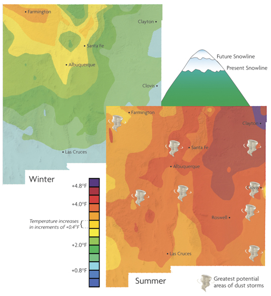
Map: Climate Change
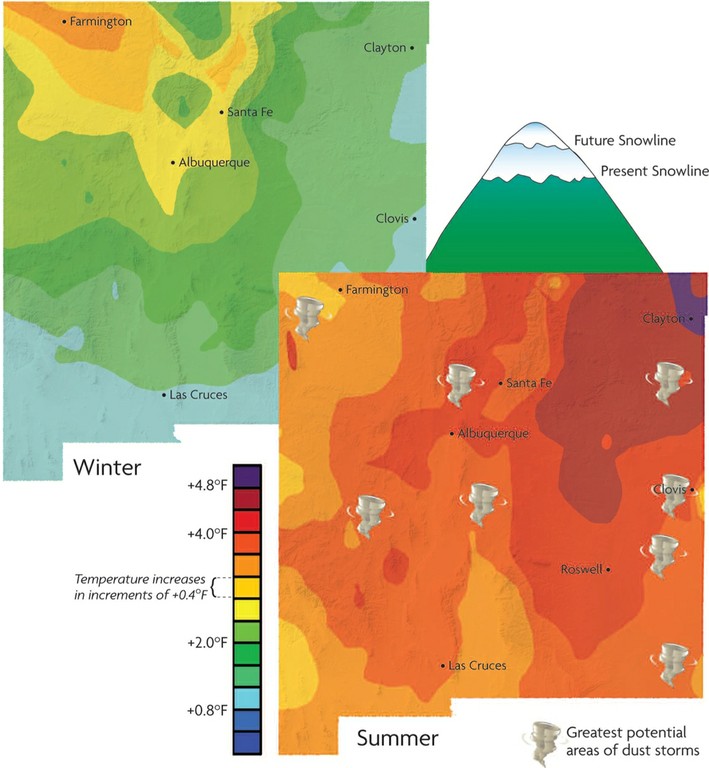
Climate Change: Maps show the likely temperature increase in both winter and summer over the next 75 years. The snowline will move 300 to 1,000 feet upslope. Predicting rainfall/snowfall change is difficult (not mapped), but it’s certain less snow will fall.
Map: Carbon Sequestration
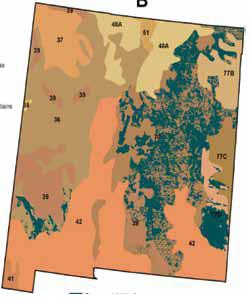
Carbon sequestration is limited in New Mexico by the amount and erratic nature of rainfall and the costs of irrigation. The map shows areas considered to have the best potential for carbon-sequestration programs because of elevation and summer rains. The Pecos Canadian plains and valleys would switch about 9,000 hectares of irrigated corn and small grains to perennial grass to sequester about 0.6T of C/ha/year and 1.1T of C/ ha/year. No-till gains little carbon. The most promising carbon sequestration would be diversifying rangeland species by adding legumes and retiring some existing cropland.
Map: Reservoirs in Drought
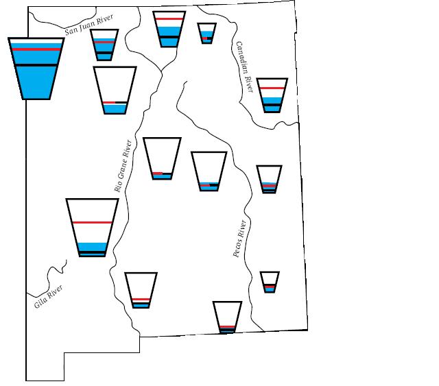
Reservoirs in drought: The “glasses” are the reservoir capacities for major New Mexico dams. The blue filling shows the level of the dams during the drought year of August 2005. The red line is the reservoir’s average volume. The dashed line was the level in 2004. The biggest reservoir is Navajo dam, which is 90% full. Elephant Butte Dam (second from bottom on Rio Grande) is 23% full, less than half its average. Caballo Dam, the most downstream dam on the Rio Grande, is only 7% full. The Pecos River dams vary from 14% to 39% full. Can this drought year become the new normal with climate change?